Adane Bedada
አዳነ ለገሰ በዳዳ
I am a Computer Vision and Remote Sensing Data Scientist at AWS interested in Earth Observation Studies, particularily in the use of remotely sensed imagery to detect patterns on Earth.
Previously, I was a Staff Data Scientist at Maxar Technologies, and a Spatial Data Scientist at Fraym. I've also worked on a couple of consultancy gigs as a python programmer and image analyst. I studied GIS, Remote Sensing and Data Science at GWU. I also received an MA and BA from two academic institution in Ethiopia.
Previously, I was a Staff Data Scientist at Maxar Technologies, and a Spatial Data Scientist at Fraym. I've also worked on a couple of consultancy gigs as a python programmer and image analyst. I studied GIS, Remote Sensing and Data Science at GWU. I also received an MA and BA from two academic institution in Ethiopia.
ሠላም:
ስሜ አዳነ ለገሰ በዳዳ ይባላል። የመረጃ(ዳታ) ሳይንስ ባለሙያ ነኝ። በትምህርት ያገኘሁት ስልጠና በሳተላይት የሚነሱ ምስሎችን በመጠቀም በአንድ ስፍራ ላይ የሚታየውን ለውጥ ማጥናት ላይ ያተኮረ ነው። በአጭሩ አትኩሮቴ በሰው ልጆችና በምንኖርባት ምድር መካከል ያለውን ግኑኝነት የሚያሳዩ ጥናቶችን መስራት ነው።
ስሜ አዳነ ለገሰ በዳዳ ይባላል። የመረጃ(ዳታ) ሳይንስ ባለሙያ ነኝ። በትምህርት ያገኘሁት ስልጠና በሳተላይት የሚነሱ ምስሎችን በመጠቀም በአንድ ስፍራ ላይ የሚታየውን ለውጥ ማጥናት ላይ ያተኮረ ነው። በአጭሩ አትኩሮቴ በሰው ልጆችና በምንኖርባት ምድር መካከል ያለውን ግኑኝነት የሚያሳዩ ጥናቶችን መስራት ነው።
Accessing images, calculating NDVI and time-series analysis using Google Earth Engine
EarthEngine | Javascript
Testing computer vision algorithms for satellite image processing and analysis
Python
Exploratory data analysis of conflicts based on Historical data collected from ACLED
R
Geographical Weighted Regression, Moran's I, & Autoregressive Spatial Model
R
Image Enhancement, Decision Trees and XG-Boost Classifer for builtup surface extraction
Python
Multi class image classification with Random Forest and Post Classification Change Detection
Python
Supervised (Random Forest) and Unsupervised (K-Means) Image Classifications
Python
Spectral Indicies(NDVI, NDVI, NDVI and NDVI) and Tassled Cap Transformation
Python
Image enhancment with filters, and dimension reduction with principal component analysis
Python
Visualization

Chrome Experment visualizaition of population size data for 7,314 Cities
WebGL
Share of commute to and from 28 counties incorporated in metropolitan Atlanta
D3.js
Share of commute to and from 28 counties incorporated in metropolitan Atlanta
D3.js

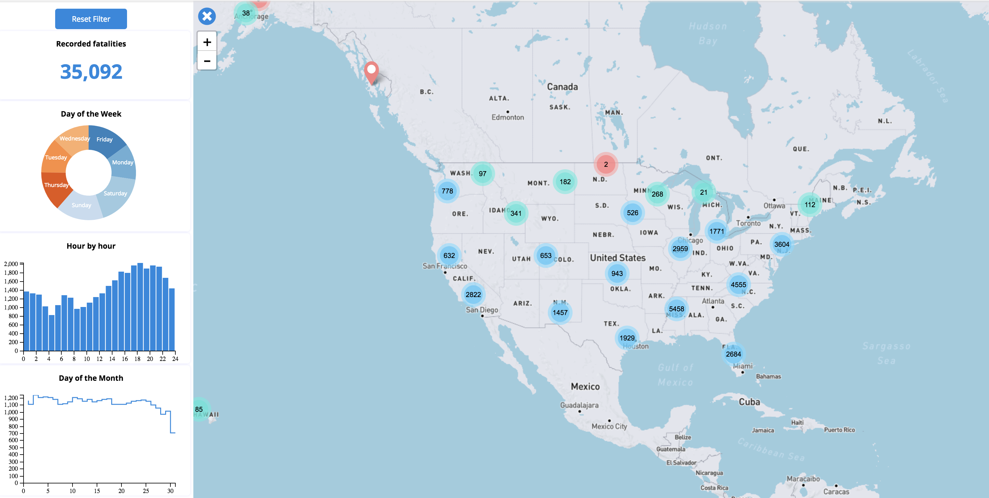
Three decade spanning spatial and temporal change in drug use related arrests in the U.S.
D3.js


March 2019 - Present
Data Scientist,
• Adversarial Machine learning, YOLOv3, Conda-Forge, Azure, EC2, S3, Sagemaker
Sep 2017 - May 2019
Teaching Assistant,
• Introduction to GIS and Mapping, GIS-II
Jun 2018 - May 2019
Research Assistant,
• Spatial Feature Extraction, HPC, Poverty Mapping, Sri Lanka, Tanzania, Belize
March 2018 – Feb 2019
Geospatial Data Analyst,
• Africa, Satellite images, R, JavaScript, CSS, HTML, EC2, S3, 2D/3D web-maps
July 2018 - Dec 2018
Software Developer,
• Time Series Modeling, California, Dimensionality reduction, Big Data, Python
May 2015 - July 2017
GIS Analyst,
May 2015 - July 2017
• Utility Mapping, ArcGIS, State-wide Outdoor LED Light fixtures
